
82 Samuel Lewis - Map of Devonshire - County Map of Devon - United Kingdom
Description
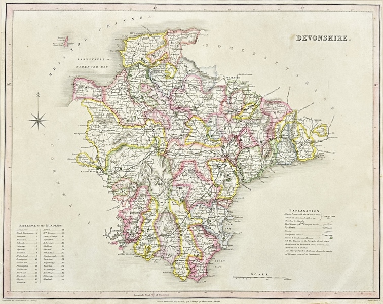
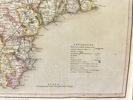
This is an original finely engraved color map of the county of Devon, then known as Devonshire, created by Samuel Lewis for the 1844 years in England. This is a geographical map that shows Devonshire, one of the counties of England. Devonshire is located in the south west of the country and is a major tourist destination due to its natural beauty and historical sites. The map allows you to see cities, villages, rivers, mountains and other geographical features of the region. It can be useful for travelers, researchers and those interested in this region.
Samuel Lewis (1782–1865) was a British publisher and topographer known for his extensive works, including "A Topographical Dictionary of England" and "A Topographical Dictionary of Ireland." These works provide detailed information about the geography, history, and local features of various places.
Artist of Maker
Samuel Lewis
Medium
Engraving
Date
1844
- Condition:This work is in good condition overall, there may be a few minor imperfections or fox or mottled marks to be expected with age. Please review the images carefully for condition details, and feel free to contact us with any questions or for a comprehensive condition report.
- Dimensions:48 cm x 38 cm
| Estimate | 1,000 - 2,000 SEK |
| Buyers Premium (inc. VAT) | 25% |
| Hammer Fee (inc. VAT) | 60 SEK |


© Software Copyright 2024 Skeleton. All rights reserved.