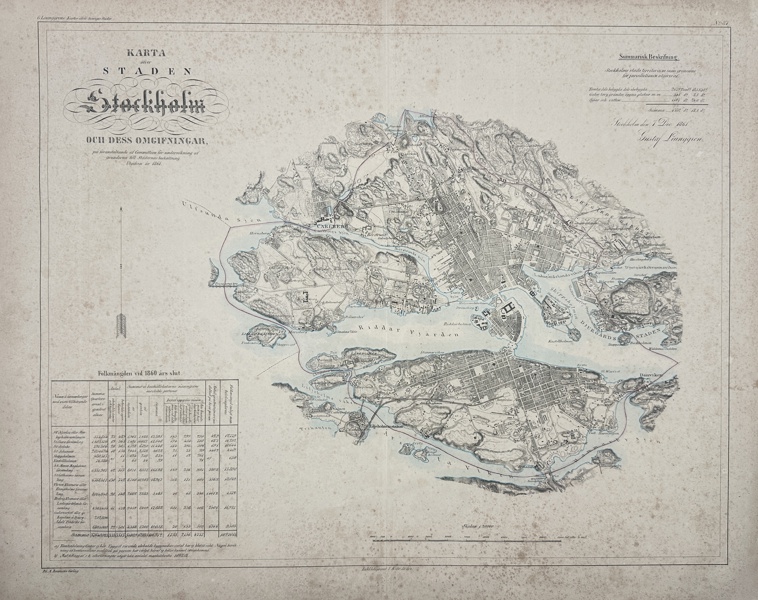
69 Gustaf Ljunggren - Map of Stockholm, Sweden

Description
”Stockholm”
Hand-coloured lithograph by Erik Gustaf Ljunggren originates from "Atlas öfver Sveriges städer jämte deras alla egor och jordar, jemte arealbeskrifningar", established during the years 1853-1861. Published by Adolf Bonnier, printed at Hörbergska Boktryckeriet in Stockholm and in connection with this, the maps were hand-coloured in beautiful watercolour painting technique.
Erik Gustaf Ljunggren (1817-1888) was a Swedish surveyor and cartographer. He became an engineer in 1854 and served as director of the National Economic Map Office and chief engineer at the National Land Survey (1869-1878).
Artist of Maker
Erik Gustaf Ljunggren
Medium
Lithography
Date
1862
- Condition:This work is in good overall condition, with minor surface wear and imperfections possibly present. Please review the images carefully for condition details, and feel free to contact us with any questions or for a comprehensive condition report.
- Dimensions:59 cm x 46 cm
| Estimate | 4,000 - 6,000 SEK |
| Buyers Premium (inc. VAT) | 24.4% |
| Hammer Fee (inc. VAT) | 59 SEK |

Dahlströms Rare Prints
Harju maakond, Tallinn
Lasnamäe linnaosa, Ruunaoja tn 3, 11415
Estland
+46 70 359 75 85
info@dahlstromsfineart.se
© Software Copyright 2025 Skeleton. All rights reserved.


